Trending Bestseller

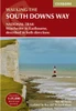
South Downs Way 7/e

No reviews yet Write a Review
Practical, all-in-one guidebook to walking the South Downs Way National Trail with 60 large-scale walking maps (1:20,000), places to stay, places to eat, what to see and public transport information.
Paperback / softback
21-February-2022
$31.99
Ships in 4-6 business days
Hurry up! Current stock:
Practical, complete guide to walking the South Downs Way, a 100-mile National Trail footpath which follows the line of chalk hills stretching from Winchester to Eastbourne in southern England. Includes * 82 Maps: 60 large-scale walking maps - 1:20,000 (3-1/8 inches to 1 mile), 11 town plans, 10 stage maps with trail profiles showing hills and descents, and 2 overview maps. * Detailed accommodation with reviews: B&Bs, campsites, pubs, hotels, bunkhouses. * Where to eat with reviews: cafes, teashops, pubs, takeaways and restaurants. * Comprehensive public transport information with frequency of services for all access points on the Path. * Downloadable GPS waypoints. * Itineraries for all walkers, whether hiking the entire route or sampling highlights on day walks, weekends or short breaks. * Unique mapping features - walking times, directions, tricky junctions, places to stay, places to eat, points of interest written onto the maps. * Flora and fauna - four page full colour flower guide, plus an illustrated section on local wildlife * Green hiking - understanding the local environment and minimizing our impact on it.

This product hasn't received any reviews yet. Be the first to review this product!

$31.99
Ships in 4-6 business days
Hurry up! Current stock:

South Downs Way 7/e

$31.99

Description

Practical, complete guide to walking the South Downs Way, a 100-mile National Trail footpath which follows the line of chalk hills stretching from Winchester to Eastbourne in southern England. Includes * 82 Maps: 60 large-scale walking maps - 1:20,000 (3-1/8 inches to 1 mile), 11 town plans, 10 stage maps with trail profiles showing hills and descents, and 2 overview maps. * Detailed accommodation with reviews: B&Bs, campsites, pubs, hotels, bunkhouses. * Where to eat with reviews: cafes, teashops, pubs, takeaways and restaurants. * Comprehensive public transport information with frequency of services for all access points on the Path. * Downloadable GPS waypoints. * Itineraries for all walkers, whether hiking the entire route or sampling highlights on day walks, weekends or short breaks. * Unique mapping features - walking times, directions, tricky junctions, places to stay, places to eat, points of interest written onto the maps. * Flora and fauna - four page full colour flower guide, plus an illustrated section on local wildlife * Green hiking - understanding the local environment and minimizing our impact on it.

Customers Also Viewed