
Trending Bestseller

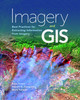
Imagery and GIS

No reviews yet Write a Review
Imagery and GIS: Best Practices for Extracting Information from Imagery shows how imagery can be integrated successfully into GIS maps and analysis.
Paperback / softback
08-March-2018
418 Pages
$195.88
Ships in 3-5 business days
Hurry up! Current stock:

Imagery and GIS, working together, expand our perspective so that we can better perceive and understand The Science of Where.


shows how imagery can be integrated successfully into GIS maps and analysis. In this essential reference, discover how imagery brings value to GIS and how GIS can be used to derive value from imagery. Learn from case studies and in-depth explanations about selecting the 'right' imagery, image analysis, how to efficiently manage and serve imagery datasets, and how to accurately extract information from imagery. The authors' experience working together on numerous research, teaching, and operational remote sensing and GIS applications bestow the book with both the newest innovations, as well as proven advice.


to obtain the most value from imagery in your own GIS projects.

You Can Find This Book In

    Book Details
    ISBN-13
    9781589484542
    Author
    Kass Green
    Publisher
    ESRI
    Published
    08-March-2018
    Format
    Paperback / softback
    Pages
    418

    This product hasn't received any reviews yet. Be the first to review this product!

    $195.88
    Ships in 3-5 business days
    Hurry up! Current stock:

    Imagery and GIS

    $195.88

    Description

    Imagery and GIS, working together, expand our perspective so that we can better perceive and understand The Science of Where.


    shows how imagery can be integrated successfully into GIS maps and analysis. In this essential reference, discover how imagery brings value to GIS and how GIS can be used to derive value from imagery. Learn from case studies and in-depth explanations about selecting the 'right' imagery, image analysis, how to efficiently manage and serve imagery datasets, and how to accurately extract information from imagery. The authors' experience working together on numerous research, teaching, and operational remote sensing and GIS applications bestow the book with both the newest innovations, as well as proven advice.


    to obtain the most value from imagery in your own GIS projects.

    You Can Find This Book In

      This Book Is Categorised As